
Navigating How to Get a Topographic Map of My Property in Florida can initially seem daunting. This blog aims to simplify that process, offering a step-by-step guide on “How to Get a Topographic Map of My Property,” mainly if you’re located in the Sunshine State. Whether you’re planning construction, landscaping, or simply interested in the geographical features of your land, having a topographic map is indispensable. Join us as we explore the tools, resources, and tips necessary to acquire this valuable document, making your property planning or improvement project in Florida a breeze.
Real estate investors Steve Daria and Joleigh have underscored the importance of obtaining a topographic map before embarking on major projects in Florida. Their experience highlights how these maps are crucial for informed decision-making regarding property development and investment strategies.
Key Points
- Check Online Mapping Services: Websites like the USGS or state GIS (Geographic Information System) platforms provide free access to topographic maps. They are easy to use—type in your property’s address or coordinates to find detailed elevation information.
- Contact Local Government Offices: Your county’s planning or zoning department may have existing topographic maps for your property. They can also help you obtain a more detailed or updated version.
- Hire a Professional Surveyor: Work with a licensed land surveyor for the most accurate topographic map. They will physically inspect your property and create a detailed map that matches your needs.
- Use Specialized Mapping Software: You can purchase or subscribe to software like AutoCAD Civil 3D or GIS programs for creating custom topographic maps. Though it requires some learning, these tools are great for property owners who want to handle mapping themselves.
- Look for Topographic Map Providers: Some companies create and deliver topographic maps. Simply provide the property details, and they’ll generate the map for you, making the process much quicker. For anyone asking “How to get a topographic map of my property in Florida?” these steps will help you quickly locate or create one.
What Is a Topographic Map and Why Do You Need One?
Understanding how to read a topographic map and knowing ‘how to get a topographic map of my property‘ is crucial for anyone looking to evaluate their property in Florida.
It reveals contours, elevations, and landmarks essential for planning and development.
Defining Topography
Topography is the detailed mapping of the Earth’s surface’s shape, elevation, and features.
A topographic map uses contour lines to exhibit the topography, highlighting the hills, valleys, and changes in terrain.
Aiding Your Location Analysis
Topographic maps are invaluable for land surveyors and developers.
They inform seismic and geological studies, uncover potential issues with soil stability or water runoff, and lay the groundwork for construction plans.
Assessing for Development
A topographic map will become your trusted blueprint if you plan a large-scale development or even a tiny home extension.
It aids site design, minimizes earth-moving costs, and ensures long-term infrastructure stability.
👇 Tell us about your property below
No obligation. No spam. Fast response.
How Are Topographic Maps Created?
Creating topographic maps involves meticulous processes combining field surveys, aerial photography, and satellite imagery to depict the Earth’s surface accurately.
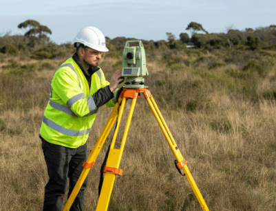
Surveying Land
Land surveyors employ specialized tools and techniques to measure elevation and distances between points on the land, forming the foundation for creating accurate topographic maps.
These professionals utilize a variety of instruments, including total stations, GPS receivers, and leveling devices, each designed to capture precise spatial data.
Total stations combine electronic distance measurement (EDM) with angle measurement to determine both horizontal and vertical positions of points on the terrain.
GPS receivers utilize signals from satellites to establish precise coordinates of survey points, offering valuable data for mapping purposes.
Leveling devices, such as automatic levels or digital levels, measure height differentials between points, aiding in depicting elevation changes across the landscape.
Surveyors meticulously collect and record these data points, accounting for factors like the curvature of the Earth and local terrain variations, to ensure the accuracy and reliability of the final map product.
High-Tech Methods
Modern techniques include LIDAR (Light Detection and Ranging), a remote sensing approach that uses light as a pulsed laser to gauge variable distances to the Earth.
Map Interpretation
Reading a topographic map might initially seem complex, but it becomes an insightful skill with some practice. Understanding contour intervals, scales, and symbols is crucial.
How to get a Topographic Map of My Property in Florida?
Obtaining a topographic map in Florida is straightforward. It is essential for property owners who want to understand the detailed geographical characteristics of their land.
Using Government Resources
The United States Geological Survey (USGS) supplies online access to topographic maps, which can be downloaded or printed.
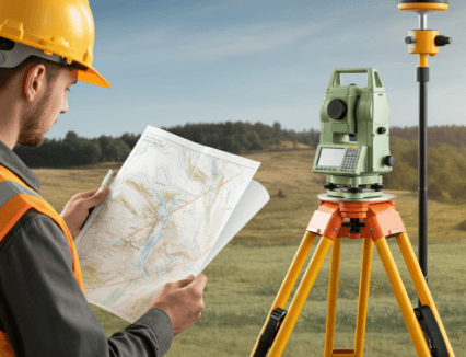
Hiring a Professional Surveyor
For precision and legality, landowners often turn to professional surveyors. They can survey the land themselves or guide you through the process.
Adhering to Florida State Standards
Florida has specific regulations and standards for creating maps, especially since the state is prone to flooding and sinkholes.
Be sure to meet all requirements to ensure your map is comprehensive and compliant.
Using Your Topographic Map
Once you have your topographic map, learning to interpret its symbols and contours is vital to uncovering your Florida property’s full potential and particularities.
Property Docs and Regulations
A topographic map might be a requirement when applying for specific building permits. It can also help with zoning regulations and environmental policies.
Designing Your Landscape
For residential homeowners, a topographic map offers insight into drainage solutions, garden design, and land-caring practices.
Planning for Conservation
Conservation is critical in Florida. A topographic map can help you identify and protect areas of ecological importance on your property.
Topographic Maps and Environmental Concerns in Florida
Exploring how topographic maps can be instrumental in identifying and navigating the unique environmental concerns present in Florida’s diverse landscapes.
Mapping Coastal Erosion
With Florida’s extensive coastline, understanding coastal erosion is vital. A topographic map highlights changes over time and can guide coastal management strategies.
Identifying Wetlands and Hydrology
Wetlands play a crucial role in the Florida ecosystem. A topographic map can help you identify and understand the hydrological landscape.
Ensuring Resilient Architecture
Hurricanes and high water tables are part of Florida life. A topographic map can help build and retrofit structures to be more resilient and navigable in extreme weather.
FAQs about ‘how to get a topographic Map of my property’
Discover answers to commonly asked questions about acquiring a topographic map of your property in Florida, ensuring you have the insights needed for your land development and planning projects.
Can I Get a Topographic Map Online?
The USGS offers an online database, and various platforms like TerraServer provide access to these maps. However, they might need modification or verification for detailed purposes.
How Long Does It Take to Get a Topographic Map?
The process can be instant if you download one from the USGS site. If you have one custom-made one, it can take a few days to a few weeks, depending on the size of the area and the details required.
What Is the Cost?
The cost varies significantly. Free downloads often have a general purpose, while commissioning a surveyor for a detailed, private map can cost thousands of dollars. It’s a matter of weighing accuracy against need.
Common Mistakes to Avoid
Avoiding common pitfalls is crucial when obtaining and using a topographic map of your property in Florida, ensuring accurate planning and development.
Misjudging the Contour Interval
One small detail with significant consequences when utilizing topographic maps is ensuring a thorough understanding of the contour interval and selecting the appropriate map for the intended purpose. The contour interval refers to the vertical distance between contour lines on the map, representing elevation changes.
Different maps may have varying contour intervals, directly impacting the detail and precision level. Choosing the correct map with a suitable contour interval is crucial for accurately assessing terrain features and planning activities such as hiking, construction, or resource management.
DIY When You Need a Pro
Topographic maps serve as vital tools in various fields, offering precise representations of the Earth’s surface features, including elevation, terrain, and landmarks. They are scientific and legal documents, meticulously crafted to adhere to specific standards and accuracy requirements.
Due to their technical nature and the critical information they convey, it is advisable to rely solely on professional expertise for their interpretation and utilization. Trained individuals possess the skills to navigate and decipher these intricate maps effectively, ensuring accurate understanding and application.
Not Updating Over Time
The land changes; from erosion to development, what you knew yesterday might not be valid today. Regular updates are essential for current and future planning.
**NOTICE: Please note that the content presented in this post is intended solely for informational and educational purposes. It should not be construed as legal or financial advice or relied upon as a replacement for consultation with a qualified attorney or CPA. For specific guidance on legal or financial matters, readers are encouraged to seek professional assistance from an attorney, CPA, or other appropriate professional regarding the subject matter.